NXT Energy Solutions Inc.

How is an SFD® Survey acquired?

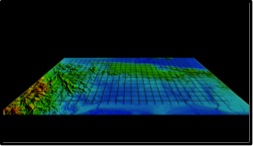
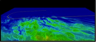
NXT Energy Solutions works closely with its clients to optimize the design of SFD® surveys, which can be tailored to specific areas of interest, geologic targets, and the clients’ exploration needs.  Often, there are known regional fields which can also be surveyed by NXT as “templates” in order to obtain additional SFD® signal data which can be analyzed in conjunction with the data obtained over the client’s target grid area.

SFD® surveys are ideally flown in a grid pattern over the target area, as this increases the likelihood of crossing and identifying the sub-surface anomaly. In addition, a grid- type acquisition allows at least two potentially different azimuthal orientations over any subsurface features that may exist in the target area. Furthermore if the same anomaly is identified by two intersecting lines within the grid, it increases the confidence in its existence. Finally the grid pattern can help to better delineate the potential spatial extent of the anomaly.

The width of the grid spacing is thus a function of the client’s objectives and cost constraints – a spatially large area could initially be covered by a wide area “reconnaissance” type survey (say 25 X 25 km) from which a subsequent tighter grid pattern (5 X 5 km) of “in-fill” flight lines could be flown over a limited number of anomalies which are identified. Most importantly the grid spacing of the initial flights is directly influenced by the size of the targets being sought – for example in a virgin frontier area the focus would be towards relatively large targets which would justify further exploration activity in the area. On the other hand, in a mature basin where the primary target might be re-evaluation of existing production acreage or to identify areas with remaining reservoir potential, the targeted features might be much smaller.

The overall SFD® survey is designed with respect to client’s target area, preferred orientation, grid spacing and density. The number of individual survey flights to be flown is a function of many factors, including:

Proximity to restricted airspace and national borders.
Local airports with sufficient runway and fuel capacity.
Size and shape of the target survey area.
Local weather conditions.

To ensure SFD® data integrity, flight lines are normally conducted with a large turn radius and have a pre-determined lead up distance prior to entering the client target area or transect.  The flight line patterns over a typical survey area might be designed as follows – in a standard grid pattern:

A completely planned and executed single flight line might look as follows:

Numerous tools are used in the search for oil and gas, and it is important to be able to integrate the outputs from various methods. NXT has years of experience integrating SFD® data with other geological and geophysical (“G&G”) data from prospect locations. Clients are also encouraged to conduct a detailed “Integration” study, whereby SFD® data is incorporated with the client’s existing seismic and other G&G data, to assess correlation and to provide further information on potential prospect areas.

Archivos

No archives to show.

Categorías

  • No categories